We were so curious to discover Death Valley! We knew it is one of the hottest places on Earth with spots below sea level and we wanted explore to see what makes it a special place for many, what is the connection with "death" and why is it called Death Valley.
Located near the border between California and Nevada, the name of Death Valley dates since 1850 when a group of pioneers who sought to cross the valley went missing. The legend says that only one of the group died there, the rest being rescued by two men. As the party climbed out of the valley over the Panamint Mountains, one of the men turned, looked back, and said "Goodbye, Death Valley."
The first impression is of a lifeless landscape. It is very hot, arid, deserted and vast land. There is certain solitude and calm in this apparent spiritless place and if you look closer, you do see signs of life. I have never been on the moon, but I imagine it looks like this.

From our previous adventures in Zion National Park we headed to Death Valley National Park, which is located about 400km distance in California. The first night we camped at Beaver Dam Mountains at the top of the mountain range, surrounded by Joshua Trees and a beautiful view. It was a steep ascent, rocky and slippery but Brutus (the truck) made it without a problem. He is a natural in these environments 🙂


The following morning we departed early to cover the remaining 300km to Death Valley. The road was great. We kept a good pace and soon we were outside Death Valley park limits. We decided to wild camp on what was left of an abandoned RV park adjacent to California State Route 190, on the opposite side of Funeral Mountains Wilderness. It was a perfect spot to rest overnight.
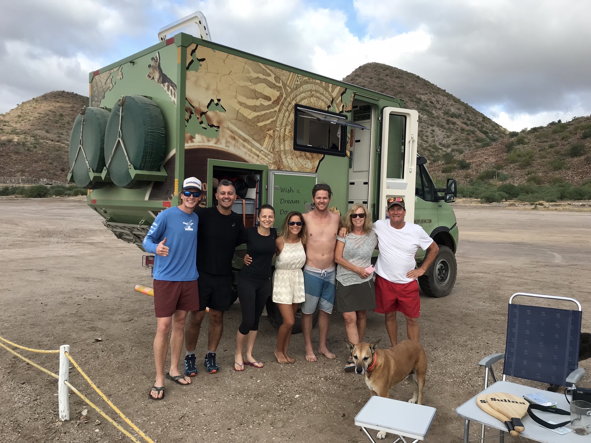
Just next to our camping spot there was a family with 3 kids traveling on a large truck towing a huge trailer. The children were so playful and cute that we decided to stop by to say hello. We learned the parents sold their business in Hawaii and decided to travel with their kids throughout USA to show them the country. They have been on the road for over a year and don’t know for how long they will travel or if they will eventually return to a ‘normal’ lifestyle. The kids were so happy running around the fire pit and playing games.
In this journey we learned that having small children do not prevent families to travel. On the contrary, they are integrated in the family’s travel plans and as we seen it they learn from these rich living experiencing while having a lot of fun.
The following morning we were ready to discover Death Valley and its unique formations.
As soon as we departed the road unveiled an extensive land of solitude, arid mountains, rocks and plain fields of salt with apparent no vegetation.


Our first stop was at Zabriskie Point where we noticed a chain of petrified sand dunes of different shades of yellow and beige. Zabriskie Point was the bottom of a lake before. It is composed of sediments of Furnace Creek Lake which dried up 5 million years ago, long before even Death Valley came into existence. The erosive landscape looked picturesque and inviting to moments of reflection.


We wanted to go for a hike that day and we chose a short one to discover the Golden Canyon. It was very dry and hot, and we drank half of our water on the first half hour on the trail. We were below sea level, literally cooking on the canyon trail. It was an interesting hike, where the only life we could observe were a couple lizards acclimatized to the harsh conditions.


We enjoyed the desolated scenery and completed our hike. It was something different, something unique. Back to the truck we made our way to the visitor center where we gathered more information about the park and watched an interpretation movie about Death Valley.
We learnt something very interesting at the visitor center. Whilst one might think the valley is lifeless, besides its own flora and fauna Death Valley has its own indigenous residents, the Timbisha Shoshone Tribe.
They have been living here for over 1000 years and do not consider it dead. On the contrary, they see the life in it and take their subsistence out of it.
People often ask: “Aren’t you too hot living here? Why do you live here in the middle of the desert?” But for them it is normal, it has been their life for generations.
The Timbisha Shoshone consider people without land to have no culture or identity. Thus, they are determined to keep their land and to continue to live in Death Valley despite the harsh conditions. Their name for Death Valley is “Tümpisha” which means “rock paint” and refers to the rich sources of red ochre paint that can be made form the type pf clay found in the valley.


We continued driving towards Salt Creek passing by a desolated plain of salt extending for kilometers. It looked pretty cool so we decided to park and walk to the white salt layers. The land appeared dry, but when we walked on it, it cracked like a thin layer of a crunchy biscuit to revel the moist soil underneath the salt. It was a quite interesting sensation, with the soil cracking as we walked. There we saw coyote footprints on the salt indicating the presence of large animals in the Park.


No so long afterwards, when we passed next to Mosaic Canyon we spotted the coyotes, one of Death Valley residents 🙂

We resumed our trip through California State Route 190 heading west through a beautiful valley. As soon we passed the Stovepipe Ranger Station, which is located at sea level, we realized the start of a steady and constant ascent as we continued through the valley towards Town Pass. Timed passed, we passed Emigrant Campground and we were still ascending. The sun was in its full force, the temperature was boiling hot and we had a bit of a tail wind. For a moment we wondered if we could have overheating problems, but JP was monitoring the truck’s temperature and there were no issues. When we finally passed Town Pass we were at 1500m altitude and the air became fresh and pleasant, to the point I had to put my jumper on. It has been a very interesting day with different sensations.

We stopped for a panoramic vista at Father Crowley Viewpoint on the top of the Mountain Pass for a couple shots. From there we could see toward Town Pass, Stovepipe Wells and Death Valley's Mesquite Sand Dunes area. That view was quite something, we could see the whole valley. We walked the dirt track east of the parking lot for a grand overlook of northern Panamint Valley.

There it was very interesting to learn from a group of photographers that the canyon next to Father Crowley Viewpoint is named Rainbow Canyon and is commonly used by the US Force Air and Navy for fight jet trainings. Military training flights have used Rainbow Canyon since World War II. We haven’t seen any, but apparently planes travel through the canyon at 500 km/h and as low as 70m above the canyon floor, very close to the photographers on the rim. All these guys there had huge cameras and were waiting for the planes to show up.
There was a Hungarian photographer that recognized our truck numbers and asked us if we were from Romania, so we started to chat. He explained us he is taking holidays in US only to take pictures to aircrafts, that he does a specific tour each year to see and photograph aircrafts. That was quite a special hobby, I thought. Silly me who initially thought they were waiting to photograph the sunset reflection on the Death Valley. We heard the sunset here it’s something absolutely fantastic from shades of pink, orange and violet.
I was not really sure if they were doing this as hobby or …maybe espionage? Were they foreign secret service officers monitoring the aircrafts, equipment, routines and training of the US Air Forces? Probably not, but why would you travel the world to photograph only aircrafts? But hey, why not …


It was a full day and a long drive involving extreme temperature changes through a very hostile and distinctive environment. We learnt more about life and choices than about arid landscapes and salty seabeds. We learnt about different kinds of beauty and about acceptance. We learnt from the Timbisha people that they discover beauty in everything and accepting the realities of your own environment, taking ownership and making the best of your situation is important for a meaningful life.
It was dark outside when we left the park so we headed to our camping spot at the Walkers Pass Campground. We couldn’t see much around when we arrived, but seemed to be a safe spot for the night. The next morning we discovered we were staying at one of the trailheads for the mythical Pacific Crest Trail, which covers 2,650 all the way from Mexico to Canada. We were at Walker Pass, which marks the boundary between the Southern and Central California. A great journey to conquer on foot for soul searching passionates.